


Watersprite Lake with a Demon Ridge Side Quest
A cheeky trip report
Trail Stats
21km round trip
8:15am start/ 4:44 return Probably 7hr30 min hiking time.
1200m elevation gain.
Directions
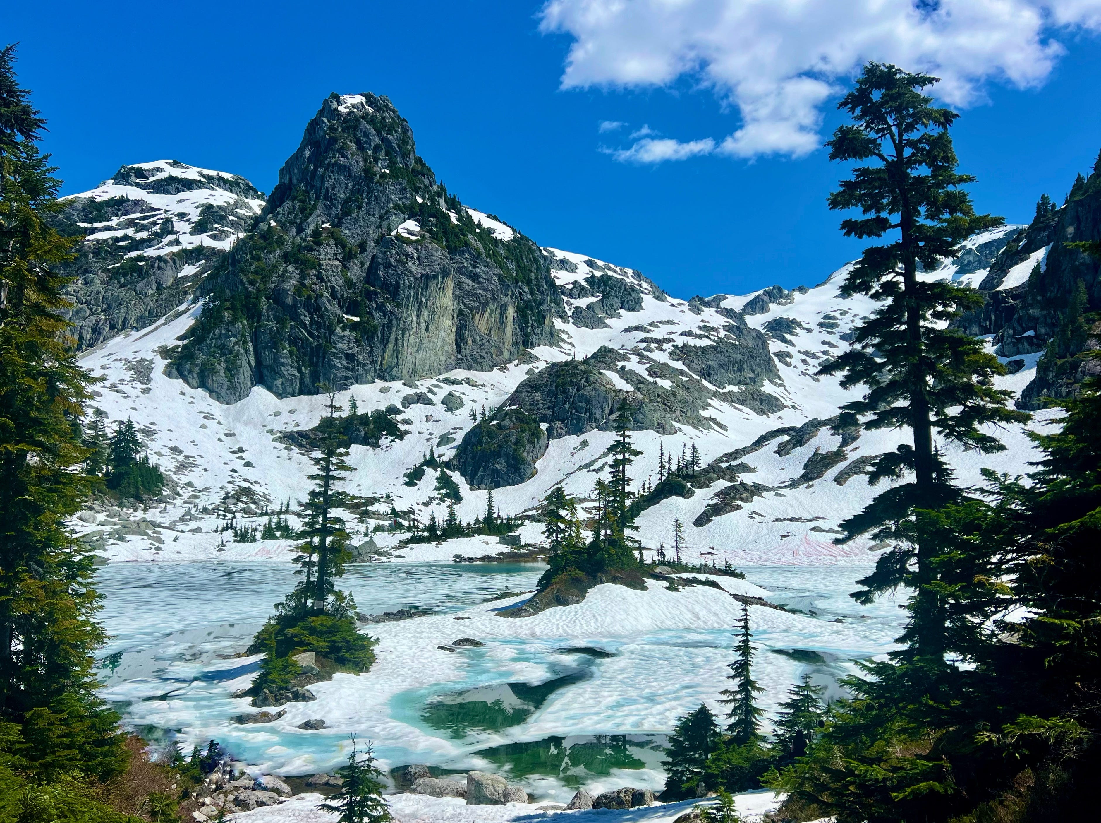
Watersprite is a stunning turquoise lake surrounded by prominent peaks. Fanciful sorts easily imagine watersprites, fairies and other mythical creatures living here. Unfortunately, the dreaminess may be diminished by exhaustion on the long walk in and grunting final ascent/decent (depending your route) to get you there. Still, the spectacular scene will win you over in the end and you’ll be happy for the slog (in that moment before thinking about the return.)
AI will write you a flowery trail report with amalgamated stats and the one perfectly edited photo that everyone takes. I prefer to talk reality- what sucked, what didn’t- then you decide if this hike is for you.
Starting with the drive in. You should have a 4x4. Probably most of you won’t. If you don’t give a shit about your car, you’ll make it so long as you have a bit of clearance and go slow. On our way out in our big ol beater 4x4, we saw a couple spots holding pieces of car left behind. Small parts, but parts nonetheless.
It’s about 50min-1hr15min from the start of the Mamquam FSR, depending on your vehicle. The directions given to me the first time I drove there on my own was ‘go left, go up, Skookum left, look for the candy canes’ I was pissed off getting those directions but this is what I leave for you because if I made it, so too can you!
If you make it and like me, had many beverages the night before, with a Timmy’s coffee gulped in-between potholes on the way in, you too will be racing up the outhouse stairs immediately on arrival. Get it done now as it’ll be a few hours before the lake and another outhouse in sight. Pack toilet paper.
Trail Map
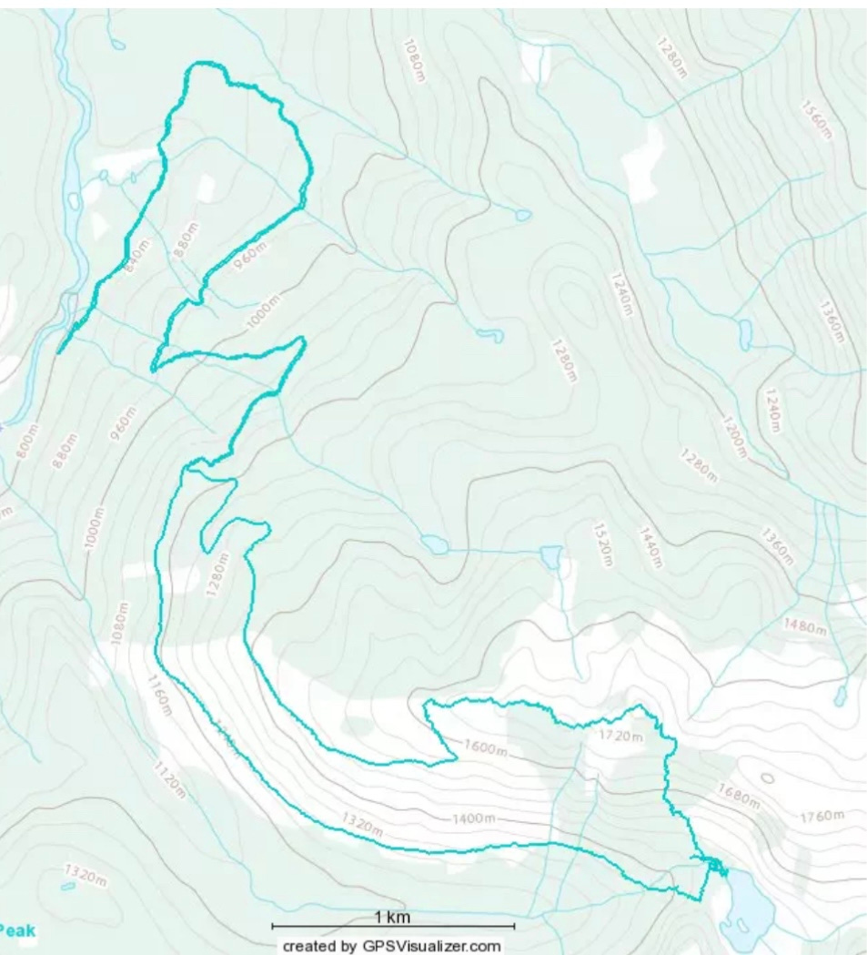
Yes there are no names, landmarks, kilometres or elevations here. I sent these contours and nameless trail to my guy as a test, but mostly to turn him on. He passed on both accounts. The guy loves zooming in on maps. This is incredibly dorky, yet somehow entirely hot as well. I digress.
This is our route today. A loop! In and outs bore me generally so somehow veering an extra 4km, and 400 meters in elevation, followed up with 350 straight down, seems reasonable. It’s not. But it is fun (if you’re into that sort of thing.)
The Hike
Walking in the opposite direction of where I need to go is incredibly annoying so the first 5km of the hike is beyond frustrating with the long, backwards switchback.
Still, with Lupins, Foxgloves and Red Paintbrush lining the trails, I forgive the out-of-the-wayness. When a robin literally leads us down the path for a good half a kilometre, landing on the trail and looking back to make sure we’re coming along and hummingbirds dart and hover in and around the trees, I happily march on, going out fast, too fast.
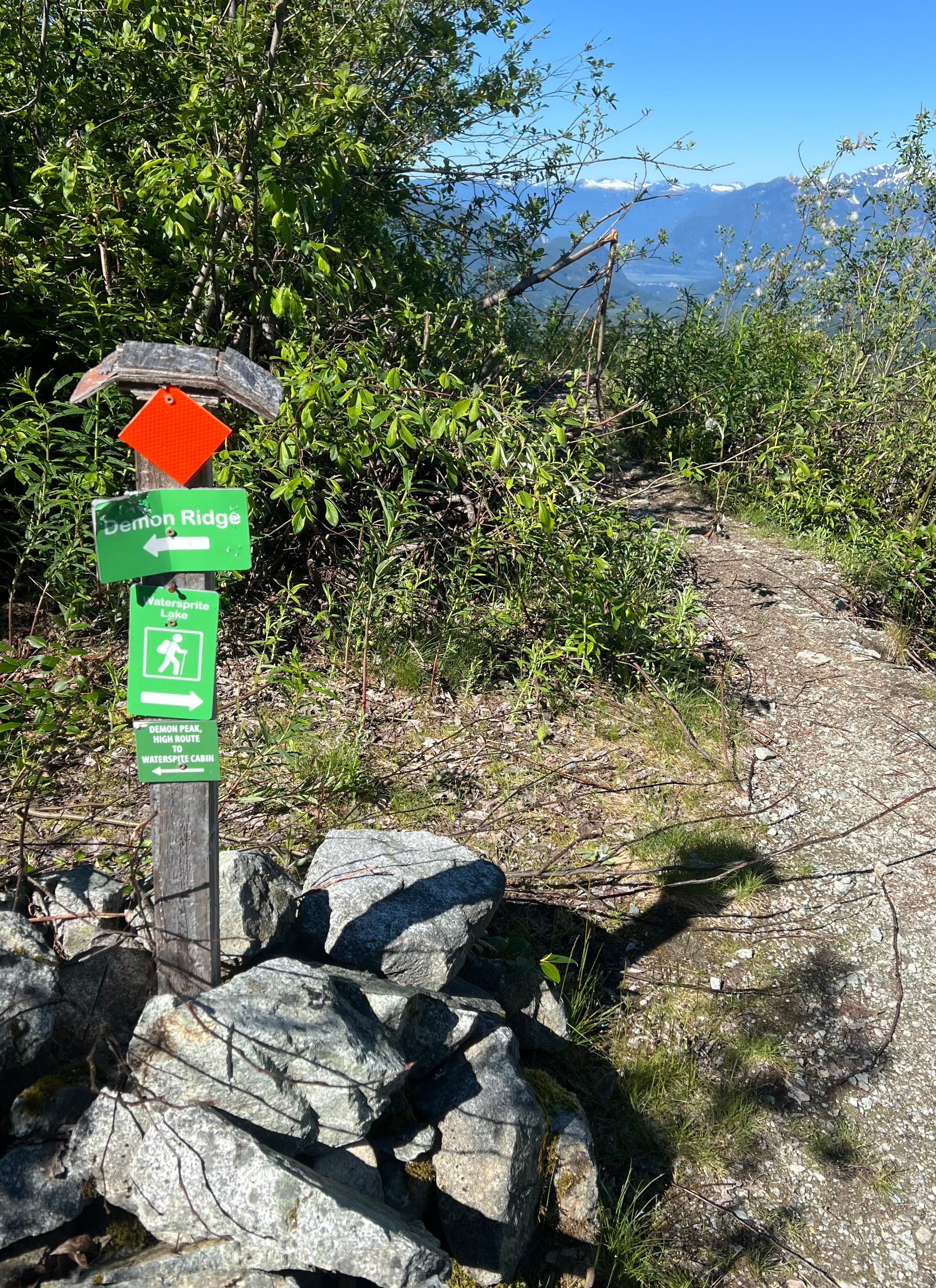
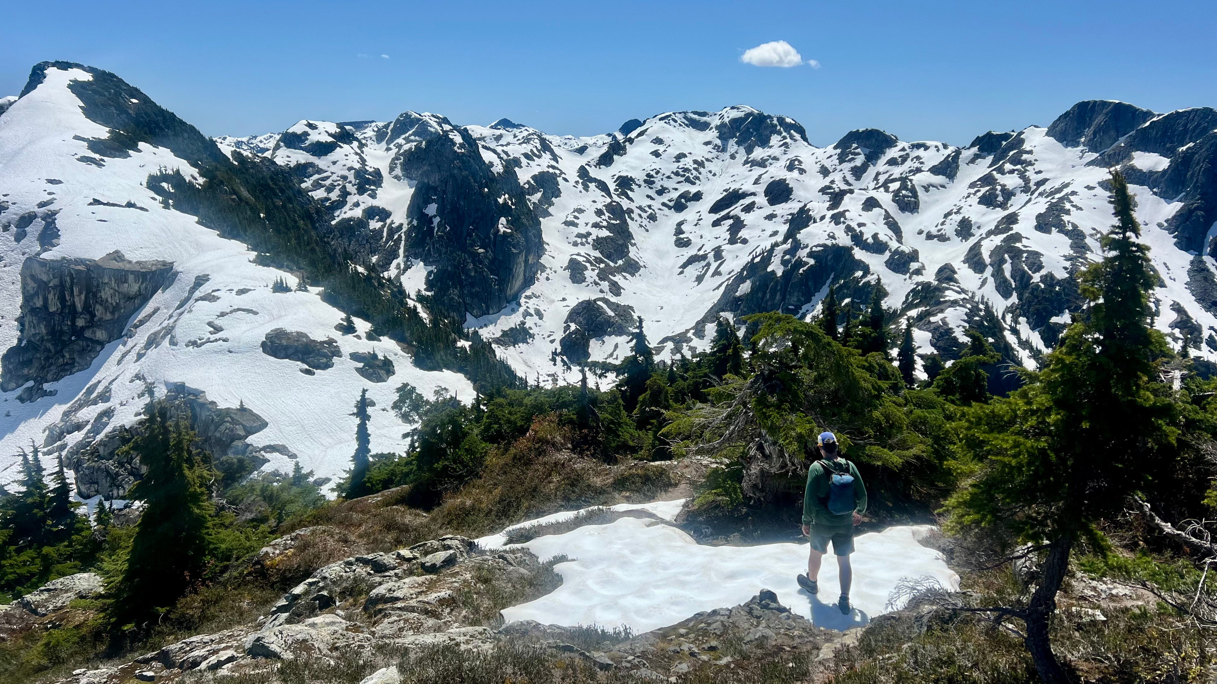
No matter, I will slow soon enough. At around the 5km mark, there is a sign for Demon Ridge. Go left if you like newer trails and elevation. If you’re going to whine about bushwalking as I read in some recent comments of this trail, go back to your car now. Bushwacking, for the uninitiated, means wacking your way through the wild. It does not mean a few branches scrape your leg and you have to duck a couple times. The trail is an obvious trail. Now you know.
Before hitting snow, we are inundated with a snowstorm of pollen. Like crazy amounts. So much that I inadvertently ingest a fluff ball of them, it gets stuck in my throat and I spend 15 minutes coughing, spitting and gagging. Energy gummies dislodge it finally and I carry on. Logging roads are my mental game nemesis, but this one provides breathtaking views that distract adequately. Upon reaching the end, say hi to the exotic-dancer grouse putting on a show and veer straight up the ditch. It’s flagged.
Steep section, cool plant life erupting and then snow at the end of June. A lot of snow! Way more than I thought. Walkable without gear, though pull out those sunglasses and poles. Postholed a couple times, slid on my ass a couple times, no exposure or scary spots (from a woman who is scared of these things.)
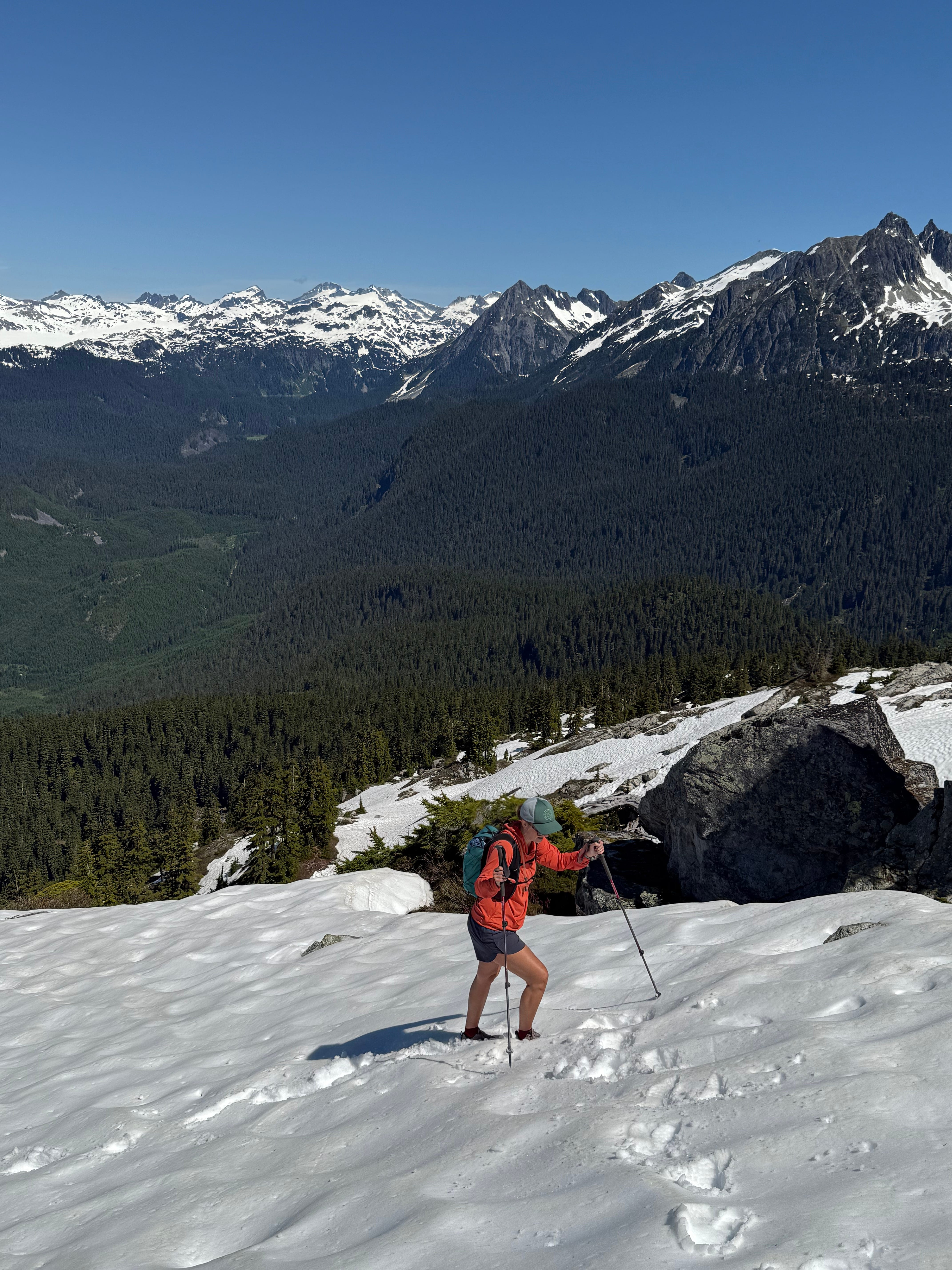
Marvelling at Mamquam’s glacier and 360 views of peaks makes for a joyful jaunt along the ridge. It should be noted that joyful jaunt includes a parade of mosquitos and flies enthusiastically welcoming you to their home. Lucky us. The peak finale includes a fireworks eruption of bugs but beyond the buzzing and swarming, the views put on a worthy show too.
We eat our hiking charcuterie of cheese, salami, cherries, nuts and gummies, before finding the trail headed down. It’s right in front the Demon Peak marker.
As we come to a viewpoint of the cabin and lake, we see the lake mostly still frozen and a fair bit of snow to tackle on our way down. It tackles us really. Nothing dangerous, just some slip sliding and minor post holing. It’s steep but the trail is obvious and it’s fairly short. Before long, you hit a boulder field with the lake on the other side.
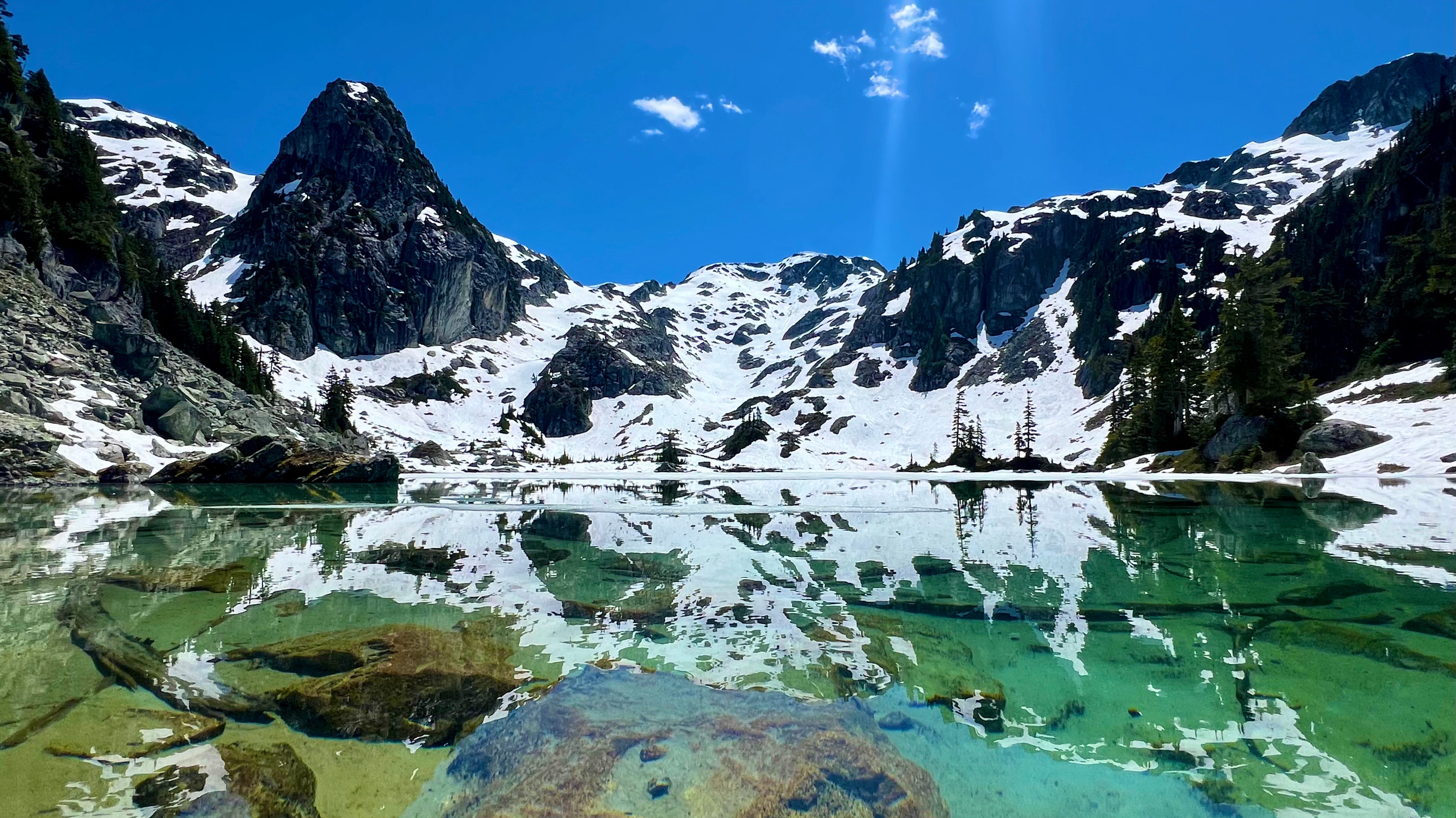
Though the day is 30+ degrees, walking in the snow has not inspired a dip. Especially after putting my legs in up to the knees just as an iceberg (dramatic much…) slowly drifts in front of me and the prickles of pain scream that I WILL DIE if I dip. Up to knees only for me then, though when we walk around to the main trail entrance to the lake, we see more people, many who are braver than I.
And now it’s time to head back on the main Watersprite trail back. It is South West facing (I think?) Just know it’s in the sun the entire time and HOT! Pack accordingly. For me, lots of water, a sun shirt, hat, sunglasses and dunking the hat in every stream we pass does the trick. Pro tip- don’t put your sunglasses on your hat because you will forget and they will go flying, probably straight into a waterfall creek. NOOOOOO! Thankfully, my partner sees it happen, watches where they land and does a few swoops into the deep rushing water and success, sunglasses!
And that’s it. 9km later, back to the start.
Long day. Hot day. Super fun day with the usual adventure wounds of bug bites, scratches and one nasty bruise. All in all, a brilliant days hike (If you like that sorta thing)
What to Bring
You know how every proper trip report has a link to the 10 essentials. I consider now that I may not have had them all and need to do better. True test here, writing what I had:
Garmin
Lots of water, a water filter and electrolytes
First aid kit
Layers- I had pants, light jacket, toque and my sun shirt which I wore most of the day
Lots of food and snacks
Pocket knife
Sunscreen and bug spray- both used extensively
What I did not pack and should have just in case:
Flashlight/headlamp
Fire starter (this would have been crucial to have, had we got in trouble in that snow. Oops. Adding to my always in the backpack kit)
Emergency Shelter
Honestly friends, there were people walking up with one plastic water bottle and not much else. Be smart out there!
And enjoy the views :)